
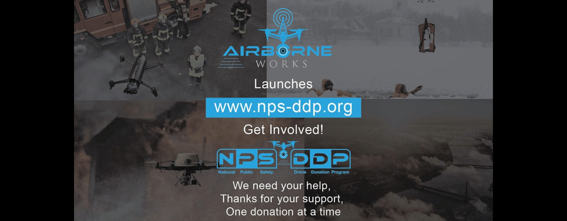

Mission Statement
Airborne Works is 100% dedicated to providing our clients with the highest level of training along with cost effective and innovative solutions for all their UAV aerial video imaging and hardware needs. Any hardware, software, and training purchases made through Airborne Works will result in a donation of up to 10% of the net proceeds to the National Public Safety Drone Donation Program NPS-DDP.org. Please note that your purchase will support underfunded public safety agencies in need. We will work hard to remain a leader within this industry, staying up to date with the most advanced UAV and digital data collection solutions as they become available and making this cutting-edge technology available to our clients with honesty, integrity and the highest level of commitment to quality. With a focus on helping the nations public safety sectors we strive to exceed client expectations and providing the highest rate of return for our clients on each and every piece of hardware or project we collaborate with.

National Distributors for Autel

National Distributors for FLIR
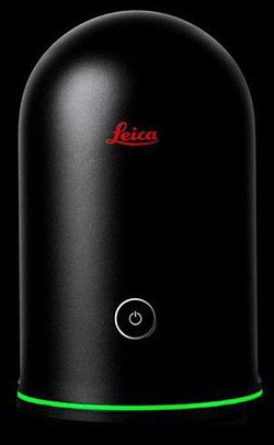
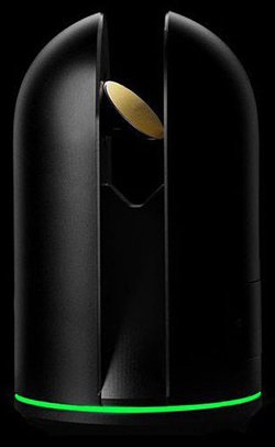
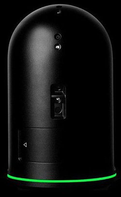
National Distributors for Leica


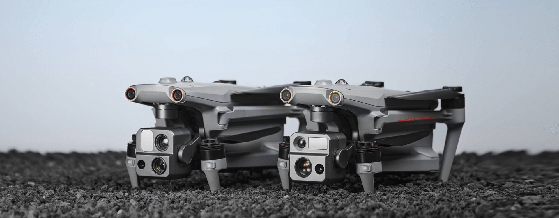
EVO Max 4T
The EVO Max series brings you advanced autonomy. It assesses complex environments to create real-time 3D flight paths for unparalleled obstacle avoidance. Advanced sensors make flight in GPS unavailable areas possible and the incredible thermal and starlight cameras unlock new object identification and tracking scenarios. With a foldable, weather-resistant design, the series is as portable as it is capable.

EVO II Enterprise V3
An improved high-quality imaging system, upgraded 9.3 miles image transmission range, and additional modular accessories help you meet a variety of use cases including inspection, search and rescue, situation overwatch, and more..

EVO Rugged Bundle 3 Reviews
EVO Rugged Bundle kit designed with First-Responders, Law Enforcement, and Commercial application in mind. This Rugged Bundle offers an SKB military-grade hard case, rated MIL-C-4150J, that protects your gear from water and dust. The custom-designed foam insert allows space to carry your EVO aircraft, up to three additional batteries, remote controller, charger, propellers, and up to a 10″ tablet.
")
EVO Rugged Bundle 3 Reviews
EVO Rugged Bundle kit designed with First-Responders, Law Enforcement, and Commercial application in mind. This Rugged Bundle offers an SKB military-grade hard case, rated MIL-C-4150J, that protects your gear from water and dust. The custom-designed foam insert from GPC allows space to carry your EVO aircraft, up to three additional batteries, remote controller, charger, propellers, and up to a 10″ tablet.

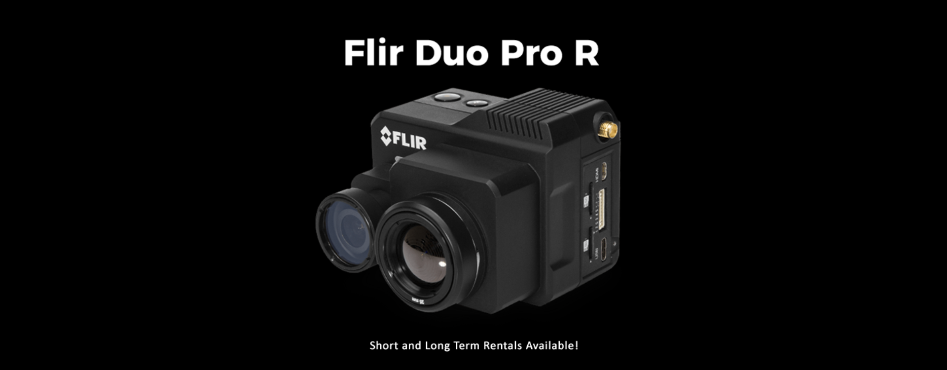
FLIR DuoTM Pro R
The reliable FLIR Duo Pro R combines a high resolution, radiometric thermal imaging 4K color camera, and a full suite of on-board sensors to bring you the most powerful dual-sensor imaging solution in the world with MSX overlay technology for small commercial drones. Capture actionable data around the clock with Duo Pro R.
*Short and long term rentals available
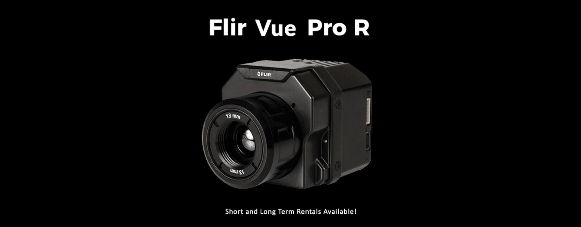
FLIR VueTM Pro R
The new Vue Pro R from FLIR gives both drone operators and certified thermographers the power to gather accurate, non-contact temperature measurements from an aerial perspective.
*Short and long term rentals available

Who We Are.
At Airborne Works we have a passion for this industry with a focus on public safety agencies. We founded the National Public Safety Drone Donation Program the only drone donation program of its kind in the world! To learn more visit NPS-DDP.org With operations in New England, Charleston SC. as well as Santa Barbara California and a network of 107 pilots nation wide we can meet any client’s needs. Aside from aerial imaging services, we are authorized national dealers for Autel Robotics, FLIR and Leica Geosystems 3D reality capture solutions. Very proud to say we are the very first UAV company in United States history awarded a contract with the EPA, pilot study program at Cape Cod. with thermal mapping and multi spectral imaging. Worked with Clemson University, National artificial reef foundation, the MDA and mapped entire Island at the Cape large projects are never a problem.
Why Us.
Our goal is to provide every client with the maximum ROI on any size project or hardware purchase. You are maybe wondering the best avenue to take to navigate the complex FAA rules and regulations to sit for the FAA part 107 license, we partnered with Remote Pilot 101 to offer the most successful study program on the Internet with over 26,200+ students within 99.8% pass rate. We sell it for less than anyone else on the web, no joke. We invest heavily in cutting edge technology and we have the experience to get the job done right the first time.
Working with industry leaders to further pioneer aerial photogrammetry with ground-based terrestrial lighter to provide simple workflows for our clients within many industry verticals including public safety. Regardless of the project, you need to know that your investment of aerial imagery is going to provide a return, we have you covered and we offer to consult and provide training services.


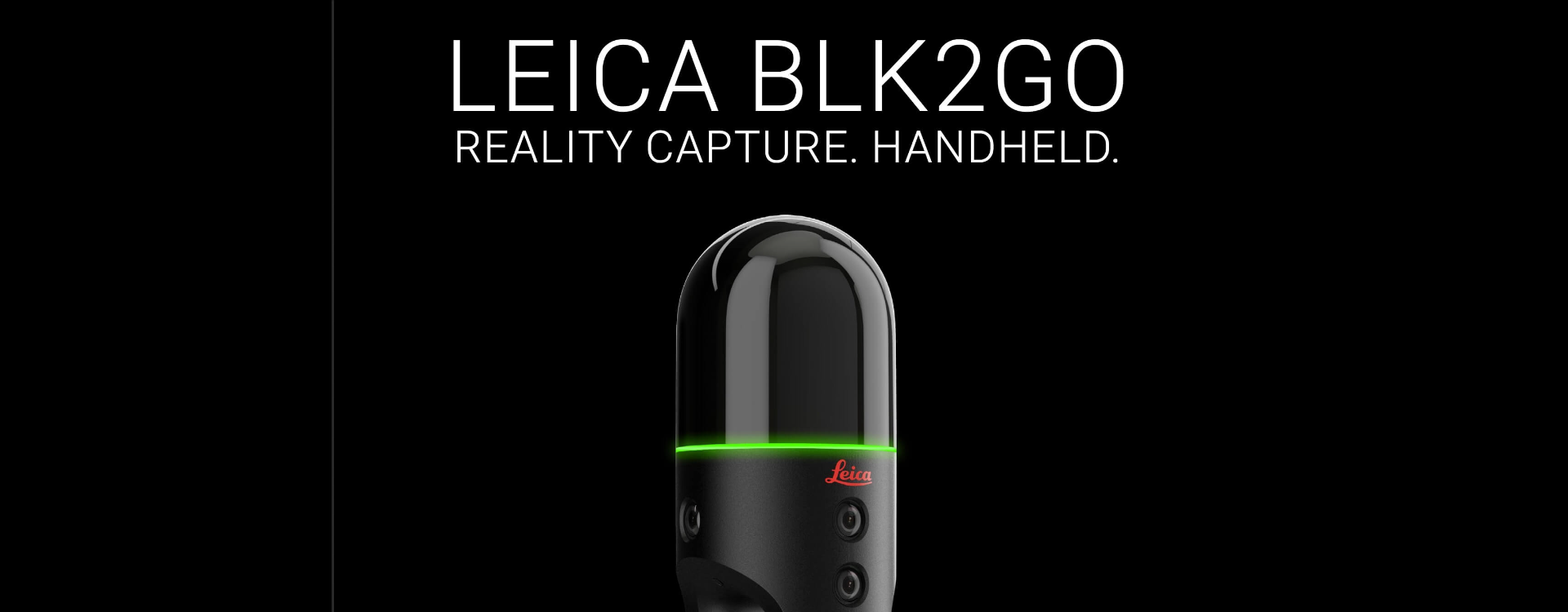
Let Us help you walk into 3D reality capture with the Leica BLK2GO
BLK2GO Brings Reality Capture to the next level For Live Demo no matter where in the country and for best possible pricing with our in-house rebate offer please contact us TODAY!
*Live Demos subject to terms contact us for details.

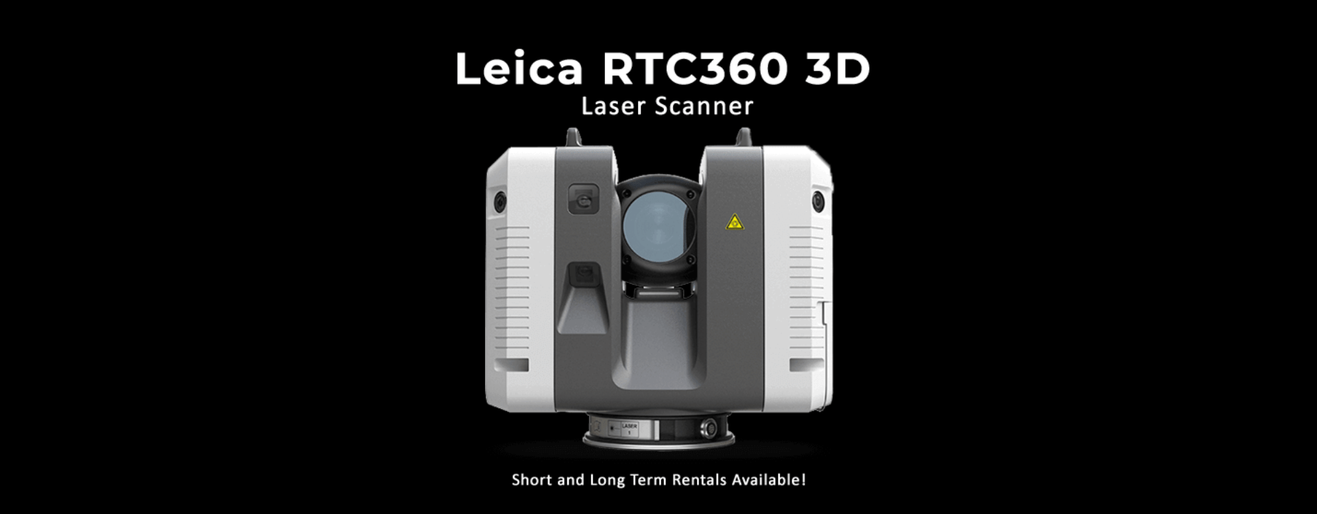
Let us help you leverage the most advanced 3D reality capture system available the Leica RTC360
The Leica RTC360 3D reality capture solution empowers users to document and capture their environments in 3D, improving efficiency and productivity in the field and in the office through fast, simple-to-use, accurate, and portable hardware and software.
*On site demos available contact us for details
Financing and leasing options available contact us for details.

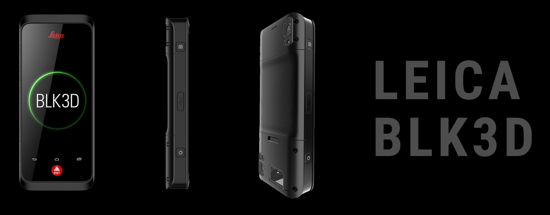
Leica BLK3D not your average camera
Take 2D images and measure In-Picture 3D data! An unmatched combination of a calibrated stereo-camera, advanced algorithms and real-time edge computing fused with leading distance measurement technology.
Take a picture and measure anything then share it real time with hyperlink with your team, and they can measure and annotate. Real time collaboration on any project.
The one button BLK3D captures images and places precise measurements at your fingertips at a price you can offord.
*Turn 2D images into 3D reality measurements! Short and long term rentals available contact us for details.

First Time Clients always receive a discount when you buy  from Airborne Works!
Public Safety
Nowadays, drones can be easily purchased around the world. There is a growing community of drone operators and hobbyists. While drones are becoming more affordable and accessible to the public, safety regulations regarding their usage remain limited. Commercial drones can present many security risks, regardless of the pilot’s intentions.
Unlicensed operation of drones above crowd gatherings can be highly dangerous since any collision can lead to the drone falling and injuring bystanders. Drones can also be used for other malicious purposes, such as surveillance or harassment. Even drone hobbyists might unintentionally fly into unauthorized airspace and cause disruptions. Bluvec’s solutions offer a means to mitigate these risks so that organizations can better protect their airspace and ensure public safety.
HAVE ANY QUESTIONS?
Give Us A Call
Reach out to our helpful customer service representatives with any questions!
Call Us Today
669-235-9482
Or feel free to email us and we will get back to you within 1 business day.
Client Reviews: We Love our Clients, And They Love Us.
Airborne Works was very good to work with. They were really detailed and arrived on time. The drone was quality work and we would definitely hire them again!The Haven at Atwater Village – The Ledges – Capture The Market